Friday, March 14, 2008

NERBAC-Cebu One-Stop Business Registering and Licensing

Link

We're aggressively promoting the services of NERBAC-Cebu. Cebu NERBAC is being made as a pilot project by the government for fast business registering and licensing.

Created through the Republic Act 7470, NERBAC is an all-in-one center that houses all concerned agencies in the government, It processes all regulatory requirements in starting a business and provides investments information on Central Visayas.

I hope businessmen will support this government move and have their businesses registered at the NERBAC-Cebu to reduce graft and corruption.

Thursday, October 19, 2006

Tuburan

Overview
The Municipality of Tuburan is located in the northern part of Cebu Province and is approximately 96.7 kms from Cebu City.

It is bounded on the North by the Municipality of Tabuelan; on the South by the Municipality of Asturias; on the East by the Municipalities of Sogod and Catmon; and on the West by Tanon Strait.

Tuburan is politically subdivided into 54 barangays.

Topography
Flat or Level lands is approximately 2,185 has. or 7.45%; nearly rolling land is approximately 11,522 has. or 39.30%; Very highly rolling lands is approximately 15,609 has. or 53.24%

Climate
Belongs to the Third type of climate in the Philippines, characterized by not pronounced maximum period of rainful.

Soil Type
Bolinao clay Mandaue Salt loam Hydrosol Faraon clay Bolinao claysteep phase Faraon clay steep phase.

Population
About 40% of the populations are farmers most of which are tilling highland areas.

Because of the low yield of these mountain areas being farmed (called "kaingin"), there is a need for the farmers to resort to raising livestock in their background to augment their family income.

Most of the farmers then raise their own large cattle either to help them in their farm (in the case of carabao/buffalo) or raise them for sale (in the case of cows).

Infrastructure and Utilities Road Network
National Road: 21.500 Kms.
Provincial Road: 8.360 Kms.
Municipal Road : 6.581 Kms.
Barangay Road : 7.280 Kms.
Ports (Domestic/International): 1

Schools (Public & Private)
Elementary: 26
High Schools: 5
College: 1
Vocational: 1
Public Library: none
Public Market: 5
Multi-purpose Building: 6
Recreation Courts/Centers : 16

Transportation Services
No. of Buses: 15
No. of Jeepneys : 6
No.of Tricycles: 15
No. of Trisicads : 24

Communications
No. of Post Office: 1
No. of Telephone Stations: 1
No. of Telegraphic Stations: 1

Power
Source of Electricity: CEBECO
No. of Barangay Served: 23
No. Household Served: 2,144

Water
Source of Water: Mun. Water System

Financial Intermediaries
No. of Commercial Banks and Money Shops: 2
No. of Cooperatives within the area: 1

Commercial Establishments
Sari-sari Stores: 245
Restaurants & Cafeterias: 12
Fresh Fish & Meat Retailers: 7
General Merchandising: 6
Service and Repair Shops: 5
Tailoring & Dress Shops: 5
Lumber and Hardwares: 4
Pharmacies and Drug Stores: 5
Marketing Firms (Appliances, furniture,etc.): 1
Gasoline Stations: 1
Bakeries: 5
Photo Shops & Beauty Parlors: 3

Raw materials available within the area
Types of Materials
1. Corn
2. Coconut
3. Coco
4. Stones
5. Sugarcane
6. Vegetables Products
7. Guano
8. Limestone
9. Rice

Existing Skills
1. Carpentry
2. Masonry
3. Electrician
4. Welding

History
The municipality was first named “Buwal” as Tuburan means spring. It attracted a lot of beautiful Tuburan women because of its abundant spring water, verdant valley and thick forest.

More than a decade later , its leader, with the full support of the people, struggled for an independent municipality which culminated on December 27, 1973, when the President of the Republic of the Philippines Ferdinand Marcos issued Presidential Decree No. 336 in 1953. After that issuance, there followed rapid economic growth in the area. (eLGU, DTI)

Labels: ,

Thursday, October 05, 2006

Tabuelan


Overview
Located on Cebu’s northwest coast and approximately 96.7 kms from Cebu City, Tabuelan is a small, quiet town with a beautiful natural harbor and fish farms.

It is bounded on the North by the Municipality of Tabuelan; on the South by the Municipality of Asturias; on the East by the Municipalities of Sogod and Catmon; and on the West by Tanon Strait.

No. of Barangays: 54
Total Land Area (Cadastral Survey): 24,648.00 Has.

Land Classification as of (Latest Year)
Arable Area: 19,820.50 Has.
Residential : 61.68 Has.
Commercial : 4.074 Has.
Industrial : 26.00 Has.
Certified Alienable /Disposable Land: none
Classified Forest/Reservation/Timberland: none
Wildlife/Military Reserve Land : none
Unclassified Forest Land/Wilderness : none
National Parks/Playgrounds : 9,386.76 Has.

Topography: Flat or Level lands is approximately 2,185 has. or 7.45%; nearly rolling land is approximately 11,522 has. or 39.30%; Very highly rolling lands is approximately 15,609 has. or 53.24%

Soil Type :Bolinao clay Mandaue Salt loam Hydrosol Faraon clay Bolinao claysteep phase Faraon clay steep phase

Infrastructure and Road Network
National Road: 21.500 Kms.
Provincial Road: 8.360 Kms.
Municipal Road : 6.581 Kms.
Barangay Road : 7.280 Kms.
Ports (Domestic/International): 1

Schools (Public & Private)
Elementary: 26
High Schools: 5
College: 1
Vocational: 1
Public Market: 5
Multi-purpose Building: 6
Recreation Courts/Centers : 16

Transportation Services
No. of Buses: 15
No. of Jeepneys : 6
No.of Tricycles: 15
No. of Trisicads : 24

Communications
No. of Post Office: 1
No. of Telephone Stations: 1
No. of Telegraphic Stations: 1

Power
Source of Electricity: CEBECO
No. of Barangay Served: 23
No. Household Served: 2,144

Source of Water: Mun. Water System

Trade and Industry
Commercial Establishments
Sari-sari Stores: 245
Restaurants & Cafeterias: 12
Fresh Fish & Meat Retailers: 7
General Merchandising: 6
Service and Repair Shops: 5
Tailoring & Dress Shops: 5
Lumber and Hardwares: 4
Pharmacies and Drug Stores: 5
Marketing Firms (Appliances, furniture,etc.): 1
Gasoline Stations: 1
Bakeries: 5
Photo Shops & Beauty Parlors: 3

Raw materials available within the area:
1. Corn
2. Coconut
3. Coco
4. Stones
5. Sugarcane
6. Vegetables Products
7. Guano
8. Limestone
9. Rice


Existing Skills
1. Carpentry
2. Masonry
3. Electrician
4. Welding


History
The Municipality of Tabuelan, formerly part of Tuburan, was founded on Oct. 23, 1953.

The old folks of the Municipality of Tabuelan attribute the origin of the town’s name from several sources. In the old days, Batawang River and the locality’s fishing grounds are noted for its plentiful “tabugok,” a kind of octopus. People would refer to this place as “tabugokan” (a native word meaning “the place where tabugok are found”) and through the evolution of words, the place came to be known as Tabuelan. (LGU)

Labels: ,

Wednesday, October 04, 2006

Tabogon


Retirement Village
A Cebuano now based in Singapore has developed a retirement village located in Tabogon, a municipality situated in the northern part of Cebu province.

A.C. Enclave Resort Homes is a small village composed of 15 individually designed bungalows on lot areas ranging from 214 to 602 square meters.

The development will address the requirements balikbayans (returning overseas Filipinos) are looking for in a property where they will consider living for the rest of their lives.

Tabogon is ideally situated 1 1/2 hours drive from the heart of the busy city of Cebu, along the coast going north.

The amenities of the retirement village are of a first class resort. The convenience of a private beach is articulated by the children’s playground, clubhouse, swimming pool, wellness center and piazza as an activity center for personal needs.

Other architectural features vary in each home, from individual water feature or hot tubs, high ceilings, loft style rooms, glass walls, and corner windows that capture a maximum panoramic sea view giving a great atmosphere of well being.

The developer who is a practicing jewelry designer commissioned seven accomplished architects all with track records in design to build fifteen boutique bungalows by the coast of Tabogon Bay.

The design concept offers a gated community in clusters of two or three homes in a setting of a botanical theme part. House areas range from 95 to 210 sqm of 2 bedrooms, 2 baths to 4 bedrooms, 4 baths.Special attention to technical details are expressed in the individual water treatment facilities, centralized water system, garbage chutes, standby power facility, telecommunication hook-ups and 24 hour security.

Jogging pathways, tree part buffer zone, mini forests and landscape promenade serve as a backdrop to these poetic modern designs built on the hill facing the Camotes Sea, thus giving a perfect blend of modern luxury and a healthy way of life.

The enclave is a botanical theme park in Tabogon with its seven coves facing the Camotes Sea and the island of Leyte, an hour and a half drive 80 kilometers from Cebu city on a less-traveled but cemented coastal road within hollering distance to 18-hole golf courses, the Club Filipino in Danao and the Mercedes Plantation Golf and Country Club in Medellin and just 15 minutes to the five-star Alegre beach resort in Sogod.

Seven architects were engaged to individually design resort houses for the Enclave. Ed Daang creates “a contemporary retreat that would optimize spectacular views of the natural landscape, water and sky and enhance the opportunity for lifestyle of indoor and outdoor living.” Arnulfo Crusit Wong University of San Carlos faculty of architecture for 12 years envisions three houses in his cluster “after all, three is not a crowd rather it is company,” naming them “Last Train,” “Hound Dog” and “Teddy Bear” cute and playful split- level with wading pools, upper decks with bar and sundial, balconies end bridges.

Chito Alcordo with impressive credentials (CIT Harvard for BS and Master’s degrees, national president of the United Architects of the Philippines and past chairman of Architects Council, Asia) came up with three houses in his cluster with an ocean view form the roof deck, a cylinder-shaped house, terraces, a high ceiling, a clerestory and skylight for ventilation and light.

Arsenio Abella with major projects in Ayala Alabang, AAP awardee in sculpture, outstanding alumnus, member of the college of fellows in architecture who believes “architecture is a sculpture of voids, a masterful use of his medium expressed in the intention of what the building wants” translates his houses in sculptural and geometrical designs.

Michael Angelo Colmenares has “solitude” in mind designing wall to wall glass solarium and “Nautilus” in the chambered clam-shaped house. Alex Medalla of the designing family, building high rise residential and commercial houses in Brunei, Hong Kong and “committed to serve the local building industry in Cebu” built houses for his cluster as “different entities, physically and formally embedded into the topographically rich landscape…” the structures “bled out from the earth where they are snuggled.”

A.C Signature Developments, Inc., is a privately-owned entity that serves as a holding company for various interests in the Philippines. As its first venture into property development it has embarked on a first of its kind concept in property development.

History
According to handed-down legend of the Municipality, the Municipality was once known as "Agoho" because it was somewhere around a tree of this species, where the first know settlement in the area was established. The tree was very huge and its foliage very thick. The tree became a landmark and eventually the place came to be known by it.


Then came wave after wave of Moro marauders in their fast vintas and with razor-sharp kris. Their shouts, as they attacked, brought paralyzing fear into the hearts of the people. Their only alternative was to free to nearby hills whenever the Moros came.

In the 16th century, the Spaniards came. They helped in the resettlement of the people, who called their hiding place "Tabogon" as a reminder of their many experience in the hands of the Moro pirates. Thus the name "Agoho" passed into oblivion, replaced by the new name, which up to the present the Municipality is called.

Upon being converted to Catholicism, the people built a big church, a rectory and a bellfry. These were built of bricks and stones and in the area where a portion of the land extends towards the Visayan Sea. These buildings, being large and massive, also served as shelters where the people can hide, in the case the Moro pirates came back.

Tabogon became a town and the people elected Pablo Hortelano as its first Capitan Municipal. During his term he proposed and enacted the transfer of the townsite to another place, then called Tagasa, 3 kilometers north of its former location. The name Tabogon was retained.

Basic Facts
Tabogon is a municipality of the province of Cebu. According to the 2000 census, it has a population of 27,827 people in 5,825 households. Tabogon is politically subdivided into 25 municipalities.


Topography: Generally hilly and mountainous

Climate: It is characterized as a distinct wet and dry season.

Soil Type:Clay loam Sandy loam Gravelly loam

Suppliers/Producers
1. Coconut
2. Vegetables
3. Corn
4. Fruit Trees
5. Root Crops

Raw materials available within the area:
1. Rock Phosphate
2. Bamboo
3. Buri

Existing Skills Available
1. Carpentry
2. Mat/Basket Weaving
3. Masonry
(LGU)

Labels: ,

Monday, October 02, 2006

Eastern Samar

Overview
Eastern Samar had been a significant backdrop of the country’s rich colonial history through the island of Homonhon, where Ferdinand Magellan first set foot on Philippine soil in 1521 on his way to conquer the Philippines for the western world.

Its tiny island of Suluan Guiuan was likewise where the U.S. Army rangers had their first encounter of the Philippine territory in 1944, three days before General Douglas MacArthur made his historic landing in Leyte.

In his account, Pigafetta, the chronicler aboard Magellan’s ship, describes the island of Humumu, now Homonhon, as so: “We found two fountains of very clear water, we called it the `Waters of Good Signs,’ having found the first sign of gold in the said island.

There also can be found much white coral and tall trees that bear fruits smaller than an almond and look like pines. There were also many palm trees, some of the good kind, some of the bad. Thereabouts are many neighboring islands. Hence, we called them the St. Lazarus Archipelago because we stayed there on the day and feast of St. Lazarus.”

Historians have since described this part of Samar Island as the “eastern gateway to the Philippines.” The coast of the small province faces the Pacific Ocean and much of the land is rugged with the vast parts forested.

The interior part is rough and hilly and covered with dense tropical vegetation but drained by numerous rivers and creeks. Mountain ranges and peaks abound in an interior. Narrow plains hug most of the coastal areas and, in some instances, the banks of its principal rivers and their tributaries.

Geography
The province occupies a total land area of 4,470.75 sq. km. It is bounded on the north by Northern Samar, on the east by the Philippine Sea, on the west by Western Samar, and on the south by the Leyte Gulf.

Political Subdivision
The province is composed of 23 towns. Capital is Borongan.

Population
As of the 1995 census, the provincial population was 58,285.

Languages/Dialects
Waray-waray is the major dialect spoken in the province.

Products

· Euchema seaweeds

Key players

· 2 companies
· 4 traders
· 120 farmers

Market

· Domestic

Trade and investment opportunities

· Additional investors are needed to meet the present requirement of their existing markets (wow philippines & DTI)

Labels: ,

Camotes

Overview
Camotes is known as "The Lost Horizon in the South" because of its unspoiled atmosphere. There are many spectacular sites, like the valleys of coconut crops, corn, and potato. Its beautiful picturesque lake, known for it's freshness and natural purity, won an award for being the cleaniest inland body of water. Unlike many other islands in the Philippines Archipelago, the fabled Camotes Islands off the coast of Danao City is a marvel. It is an astonishing toll of spectacular contrasts.

Until recently, these picturesque islands have remained remote and untouched. When visiting Camotes, enjoy the pleasures of pastoral rural setting and relax in the tranquility that comes with the setting of the sun. Camotes consists of four islands; Pacijan Island, Poro Island (Poro & Tudela), Ponson Island and the tiny Tulang Island. Pacijan and Poro islands are actually joined together by a paved road. Ponson island is separated by the Camotes Sea, and lies about (4) four kilometers northeast from Poro island. Tulang island is located to the north of Pacijan. Tudela, Poro, San Francisco and Pilar are four largest settlements on Camotes.

Majority of houses are built near the seashore alongside roads that circle all three islands. Some houses are scattered in the island's interior. The highest point of the island is 386 meters above sea level. It's climate is characterized by distinct dry season. The island is approximately 562 kilometers south east of Manila, 62 kilometers north east of Cebu and 25 kilometers west of Ormoc. Camotes Island has a total size of 20,964 hectares.

Climate
Camotes as a whole enjoys tropical weather the whole year round. We only have 2 seasons. The dry and the rainy season. The dry season is from March to June while the rainy season is from July to February. The nippy air of "Amihan" or the north easterly wind blows from September to March. From June to August, the south westerly wind or the "Habagat" turns up.

The "Habagat" wind normally goes through an eight days cycle, which means, eight days of storm and rain. After 8 wet days, the weather abruptly changes to sunny and dry, consecutively. During this season, Camotes Island is frequently visited by typhoons and low depression, wherein it floods the whole island, and blows the native houses' rooftops away.

Transportation
Camotes islands have a small airport, however, most of transport to and from the islands is serviced by sea transport. Polynesian like style boats with two outriggers are used for transport of people and cargo from Danao on Cebu island and from Ormoc City. These open boats are called "pamboat" and they are a real thrill to ride when the weather is fine. The totally enclosed speed boat "Ocean Spray" runs to Cebu City and back to Camotes a few times per day. The Ocean Spray boat departs from Pier-1 in Cebu and lands in Poro. Some people use this boat for commuting to work in Cebu because there is not much industry in Camotes islands. The travel time is a leisurely 4 hours on a clean and comfortable large boat.

Fares from Cebu to Camotes Island and vice versa:Tourist: P280.00 pesosEconomy: P220.00However, if you miss this boat, you will have to travel north of Cebu to Danao City, which is about an hours' drive north of Cebu.

Pumpboats to Camotes Island:From Ouano Wharf, Mandaue City daily at 1:00pm/Fare: P200.00From Danao City to Camotes Island/ Fare: P 180.00 From Ormoc, Leyte to Tudela, Camotes Island: Pumpboats departs at 09:00AM and 01:00PMTravel Time - 3 hrs.Motorcycles are used as the main means of transport within Camotes islands, unlike tricycles which are used throughout Philippines for people transport over short distances. Camotes Islands have only narrow trails to many places that are accessible to two wheeled vehicles only.

Light and Water
The two major sources of lighting is power and kerosene which are utilized by 43.9% and 55.5% of the sample house holds, respectively. Common source of water on the island is the community water system consisting of public faucets and individual (private faucets), at 40.6% and 23.8% respectively. Around 16.1% indicate tube/pipe well as a source of water; a 0.3% dug wells; and 5.2% spring. A 220V. The power depends on Camotes Electric Cooperative (CELCO) that energizes the mainland Camotes spring water by gravity. Jetmatic and deepwell pumps are great source of water. Some parts of the island, don't have water supply. They keep big water container jars and collect rain water during the rainy season.

Communication
A postal service office and telecommunication offices provide communication services. Otherwise, a cellular phone is accessible in all parts of the island. Landlines are also available for business and residential purposes which is powered by Globelines communication. Since there are landlines like globelines, a dial up service is available. Smart offers WIFI in Camotes, but they need to come up with more customers before they can offer the service to the island. Not many people in camotes owns a computer so it may take a while for SMART to offer this service. Philippines Long Distance Telephone offers a wireless internet connection that would be applicable to all the islands all over the Philippines.

Health Services
The municipal health center is provided with an ambulance. A private community clinic at southern poblacion also provides medical services.

Accommodations
In Esperanza, Poro, there's a hotel called My Little Hotel. They offer a lot of services with a variety of good food.
The islanders are group of warm, caring, and hospitable people. Numerous families are more than glad to play host to tourist and visitors through thier "Home-stay" program.Granada Pension House rent airconditioned rooms.Please inquire the local Tourism Council through PLDT 109 for reservations and for furthur details.EconomyAgriculture predominates with copra as top grosser as well as rice, corn, vegetables, fruits, root crops and some varieties of fish. Other small enterprises are livestock, poultry, pottery, hollow blocks-making, furniture, and soap-making.


History
When the Spaniards first arrived in the Camotes Islands, they met some natives digging potatoes, and asked them the name of the island. The natives, thinking that they were being asked what they were digging, replied, "Camotes." Thereafter, the island retained that name, camotes, or potato island. (camotes)

Labels: ,

Friday, September 29, 2006

Bantayan

Bantayan Island is located at the northern tip of Cebu. Its beaches are well known for its fine white sand. It is one of the major tourist destinations in the Philippines and is popular among Europeans.

Aside from tourism, the island, which is composed of three municipalities namely Bantayan, Madridejos & Santa Fe, is also widely known as the Egg Basket in the neighboring regions. Generating over one and a half million eggs a day to supply the growing demand of eggs for mainland Cebu, Negros, Panay and even Leyte.

The island is a mixture of many things. An ideal place for relaxation and self-exploration, enjoying is one thing. A favorite hiding place to those who need a break on the busy and fast changing world. The people is as natural as the place.

Whether snorkeling, windsurfing or playing in the sand, Bantayan has all the ingredients mixed with fun, sun and silicon to be a shining tropical paradise in Asia. Tourists as far as Europe fall in love with its powdery white sand and crystal clear blue waters.

Many of these foreigners even settled down on the island to spend the rest of their lives. They build single-cottage beach houses along the shore but as time went by, build a couple of new cottages instead to accommodate the growing number of tourists who seeks refuge on the magnificent island paradise.

A mixture of cuisine is served on Bantayan island with a mouthful of restaurants serving Filipino, Thai, and Japanese to European menus. A vast array of seafoods fresh from the day's catch is very well served since most of the inhabitants of the island are fishermen that cast their nets on the bountiful Visayan seas. One can even visit the wet market to witness fishermen unpack their precious catch from the sea.

Fresh live fish from groupers to blue marlin's are just two of the many surprises. Shrimps, crabs and lobsters are displayed in abundance in the market. After a full meal one can choose a variety of fresh fruit shakes ranging from mango to choco banana.

Aside from the ambiance of a tropical paradise, the island is fully packed with the latest needs of modern life. Communications is covered by the country's two biggest players in mobile communication. A reliable internet connection is also available with a number of internet cafes sprouting on the town proper. It is not surprising to have beach lovers lugging a laptop while sipping pinacolada.

One of the reason the island is famous is its serenity, the way a resort should be. Unsaturated beauty and a mixture of sweet smiling natives made the island as it is now.

The island is predominantly Christian, aside from the fact that it seats the oldest church in the Visayas and Mindanao, it is also dubbed as the Lenten capital of the Visayas.

Many people from Cebu and as far as Manila go to Bantayan not only for a swim and relaxation but also to witness the holy week procession and to observe the most solemn practice of faith. Due to this, almost all resorts double their rates at this time of year.

On Maunday Thursday and Good Friday, both locals and visitors gather by the thousands at the town center of Bantayan to be part of the Lenten procession of religious icons and images symbolizing the Passion of Christ. Such religiosity only reflects the Bantayanon's unquestioned faith in Christ therefore making the island one of the safest place in the country.

Basic Facts
Population Bantayan - 68,125
Sta. Fe - 22,956
Madridejos - 29,020 (As of May 2000 Survey, NSO)
Religion - Christian (Roman Catholic)
Language Cebuano (Cebu's dialect), Filipino Tagalog. English is widely spoken

Moving around One may ride the trisikad(bicycle with sidecar) for short distance only, costs you around 5.00 to 10.00 Pesos. Same with tricycles(motorbike with sidecar) to get you around town proper and to the cultural spots.

The best way to explore the island is to rent a motorbike(500 pesos/day). Resorts have their own vehicles which you could rent to take you anywhere.

Currency- Philippine Peso although foreign currencies are widely exchanged in resorts and banks. Currently resorts and restaurants do not accept credit cards although negotiations are now ongoing for online payments, so better exhange those few bucks while in Cebu.

Electricity Power supply is 220 volts. Be warned that brownouts are quite often although resorts have their own power generation facilities.

Communications
The island is covered by both Globe Telecom and Smart Communications for mobile voice and data communications. Internet facilities are available in most resorts and internet cafes in the town proper.

Labels: ,

Thursday, September 28, 2006

Boracay

Overview
The palm-fringed island of Boracay – with its white, talcum-fine beach, balmy weather, and warm, crystalline waters – is like a hypnotic magnet.
In this tiny, butterfly-shaped island at the northwestern tip of Panay in
Western Visayas, days can be spent simply lazing on the beach while nights are for indulging in the tropical party lifestyle.The best part of the island is the four-kilometer White Beach hailed as the “finest beach in the world.”

The surrounding water is shallow and the sand is finer and brighter than most beaches in the archipelago. White Beach is so fine that it feels like treading on miles of baby powder. The code in Boracay is strictly informal.

There is an undeniably easy atmosphere in the island, where walking barefoot than shod is the rule rather than the exception. Even swinging discos have the beach for a floor, giving dance a new twist.

During the day, tourists having a soothing massage under the shade of a coconut tree beside the shoreline is a common sight. And from dusk to dawn, Boracay turns into one big party place where everyone is welcome to join in.

Diversions are not a problem, with leisure activities calendared throughout the year and amenities offered by some 350 tourist establishments. There is plenty to do other than beachbumming and partyhopping.

For the adventure-driven, there is ""Mambo Number 5"" – a little bit of boating and wind surfing, a little bit of scuba diving, a little bit of trekking, a little bit of mountain biking, and a little bit of golf.

On the eastern side of the island is Bulabog Beach, a boardsailor’s mecca that draws enthusiasts from all over the world, especially during the peak season from November to March.

In January, it is the site of an International Funboard Cup.Sailboating and kayaking are popular sporting activities, with Boracay playing host to the annual Paraw Regatta, an international sailboat race that makes use of the native outrigger.

Dive sites surround the island and are learning venues to both novice and professional divers, guided by competent instructors of the many dive shops that operate in the area.

Trekking and mountain biking can also bring the intrepid to the island's quaint interior villages and to the edges' scenic rocky cliffs, discovering along the way many hidden coves with isolated beaches far from the tourist crowd.

And for golf bugs, Fairways and Bluewater Resort Golf and Countryclub has an 18-hole championship course.

Geography
Boracay Island belongs to the Western Visayas island-group, Region 6 of the Philippines, along with the western part of the province of Negros, the island of Panay, and many smaller islands. The westernmost island in Western Visayas, Boracay borders the provinces of Mindoro to the northwest and Romblon to the north.

Languages/Dialects
Other than Tagalog/Filipino and other local dialects, English is widely spoken in Boracay. Akeanon is predominantly spoken in Aklan, the gateway to the island.

Climate
March to June are the summer months in Boracay, with temperatures reaching as high as from 28 to 38 degrees Celsius. November to February are spent with pleasant winds, cool nights, and occasional rain showers. July to October are the wettest months.

Boracay is known for the following:

Beaches / White Beach
Boracay boasts of a sugary white sand beach and azure blue waters. The best part of the island is the four-kilometer White Beach known to be the "finest beach in the world." The surrounding water is shallow and the sand is finer and brighter than most beaches in the archipelago. White Beach is so, soooo fine, it feels like treading on miles of baby powder!

Aquasports
The island paradise of Boracay is a perfect place for watersports. Here, you can partake in a smorgasbord of exhilirating aqua action - from swimming and snorkeling to scuba diving, windsurfing, sailboating, kayaking, boardsailing, and boating.

Nature Tripping / Eco-Adventure
World-renowned Boracay is an adventure island ideal for island hopping, hiking, trekking, caving, mountain climbing, biking, and horseback riding. Trekking and mountain biking can bring even the intrepid to the island's quaint interior villages and to the edges' scenic rocky cliffs, discovering along the way many hidden coves with isolated beaches far from the tourist crowd.

Boardsailing at Bulabog Beach
On the eastern side of Boracay Island is Bulabog Beach. It is a boardsailor's mecca that draws enthusiasts from all over the world, especially during the peak season from November to March. In January, it is the site of an International Funboard Cup.

Paraw Regatta
Sailboating and kayaking are popular sporting activities, with Boracay playing host to the annual Paraw Regatta, an international sailboat race that makes use of the native outrigger.

Diving
Dive sites surround the island and are learning venues to both novice and professional divers, guided by competent instructors of the many dive shops that operate in the area. For trueblue scuba diving enthusiasts, Yapak in Boracay is a great deep dive.

Recreational Sports
Laid-back Boracay is the perfect venue for golf, tennis, bowling, even beach volleyball. Top-of-class amenities for these activities are available in the island. For golf bugs, Fairways and Bluewater Resort Golf and Countryclub has an 18-hole championship course.

Partyhopping
The code in Boracay is strictly informal. Walking barefoot than shod is the rule rather than the exception. Swinging discos have the beach for a floor, giving dance a new twist. From dusk to dawn, the island turns into one big party place where everyone is welcome to join in.

Mambo Number 5
For the adventure-driven, "Mambo Number 5" is a little bit of boating and wind surfing, a little bit of scuba diving, a little bit of trekking, a little bit of mountain biking, and a little bit of golf.

Shopping
Bargain shopping is a joy of a diversion while in Boracay. Souvenir pieces provide endless possibilities, from trinkets and native accessories made of shells and semi-precious stones to exotic or contemporary beach wear and fashion artworks.

Dining
The taste of the 6th Region, to which Boracay belongs, is quite simple. Charbroiled chicken is common fare. Another favorite dish is raw fish marinated in spicy vinegar. Dining is no problem in Boracay, with most resorts having their own restaurants that serve both Filipino and international cuisines. Small snack bars line the island.

Relaxation
Diversions are not a problem in Boracay, with leisure activities calendared throughout the year and amenities offered by some 350 tourist establishments. The island is ideal for beachbumming, relaxing, and simply lazing around. At the end of the day, unwind with a relaxing massage. The island never runs out skilled masseurs offering massage services by the beach. For a more luxurious treat, visit the new Mandala Spa.

Boracay Boardsailing
The picture-perfect tropical island of Boracay offers flat-water speed sailing, wave jumping, and longboard cruising. White Beach, shielded from the amihan, or northeast monsoon, is for beginners. Bulabog Beach, on the other side of the island, has ideal conditions for speed, slalom, and high-wind shortboard sailing. It is also the site of the annual Boracay International Funboard Cup. Tabon Strait has superb high-performance sailing, but there is a real risk of being swept away, so this site is for skilled sailors only.

Tibiao Whitewater River
Rising near the peak of Mt. Madja-as, the Tibiao River descends almost 2000m on its short but tumultuous journey to the sea. The lower section of the river, known as the “Chicken Run”, is grade 3; the more difficult upper section reaches grade 4. The Tibiao has all the classic features of a tropical whitewater river, with rich vegetation hemming the banks, views of rice terraces, spectacular falls and clear water. The river is close to Boracay and easily accessible. (wowphilippines)

Labels: ,

Wednesday, September 27, 2006

Negros Occidental

More than just the sugar, Negros Occidental offers the modern amenities of big city life without its hassles.

Negros Island, the fourth biggest island in the Philippine archipelago, lies near the central part of the country. Negros Occidental, in the western side of the island, is one of the 6 provinces comprising Region VI, Western Visayas.

It has a total land area of nearly 8 thousand square kilometers and a coastline stretching 800 kilometers. The province is composed of 13 cities and 19 municipalities with Bacolod City as its capital.

Parts of the province are largely level plains and gently rolling slopes separated from its neighboring province of Negros Oriental by mountain ranges. The most famous of these mountain ranges is Mount Kanlaon.
541 thousand hectares of Negros Occidental’s land area are alienable and disposable. The rest are forestlands.

Around 98% of the alienable and disposable lands are agricultural areas, including built-up spaces. The remaining 2% are fishponds.

The province is blessed with generally pleasant climate with an average temperature of 26 degrees Celsius. It has two pronounced seasons: dry season from December to May and rainy season from June to November.
Negros Occidental has a population of about 2.6 million. It is the fourth most populous province in the Philippines with 54% of its people living in rural areas.

Hiligaynon is the widely used dialect. However, most of its people are proficient in Pilipino, the national language, and English.

Negros Occidental has a high literacy rate of 91% and employment rate of 89%.

The Negrenses, as the people of the province are called, are regarded as affectionate, fun loving, highly educated, skilled, and entrepreneurial individuals.

The economy of the province is principally driven by agriculture. Land is where the wealth of the province originated and continues to emanate.
Of the agricultural areas, sugarcane occupied 161 thousand hectares, followed by rice with 113 thousand hectares, and the remaining spaces devoted to corn, coconut, fruit and vegetable crops, including built-up spaces.

Sugarcane has been cultivated in the province since the mid 18th hundreds and has been the key factor in bringing material growth to Negros Occidental. Today, it still dominates the economy and the landscape of the province. Negros Occidental’s output of more than 1 million metric tons for crop year 2002-2003 accounts for nearly half of the country’s sugar production in an industry that generates an estimated annual revenue of more than P18 Billion.

There are 12 sugar mills in the province, of which only 10 are presently operational. Victorias Milling Company has the highest rated capacity with 15,000 tonnes cane per day.

However, the volatility of the sugar industry forced the province to shift, albeit slowly, to other high value crops and alternative industries. The diversification has proven to be successful.

Production of rice, the basic commodity for food security, has been increasing. Corn also registered increasing gains. Other fruit and vegetable crops, except for banana and cassava, likewise improved their harvest.

Livestock and poultry are industries where Negros Occidental has strongly diversified. With the province successfully quarantined from the dreaded Foot & Mouth Disease and the Bird Flu, and with other endemic diseases under control, total production of livestock and poultry in 2003 of 49 thousand metric tons exceeded estimated local demand by 18%.

Fishing is likewise an industry where the province has remained focused. After all, 9 of its cities and 16 of its municipalities are located along the coast and a great portion of the population depends on fishing for their livelihood.

The area for exploitation by this industry is huge covering most of the coastal areas and the rich fishing grounds of the Visayan Sea on the north, Sulu Sea on the south, Tañon Strait on the east, Guimaras Strait and Panay Gulf at the southern portion of the province. These rich coastal areas and fishing grounds continue to be generous to the people of Negros Occidental.

The province is rich in mineral deposits. Minerals that abound in the province are primary copper with estimated reserve of 591 million metric tons and gold ore with estimated reserve of 25 million tons.

Silver and molybdenum deposits are also abundant, as well as non-metallic minerals suitable for agricultural and industrial uses.
Notwithstanding its great potential, the mining industry in Negros Occidental has remained virtually dormant since the biggest copper mine in Sipalay suspended its operation.

Another industry being pushed by the province is tourism. It has a high synergy with other industries and a multiplier effect on consumption and services. However, local tourism in Negros is very strong.

Negros Occidental is endowed with beautiful natural scenery and attractions, rich historical and cultural heritage as well as festivals and events that make it an attractive tourist destination. The gentle, affectionate and fun-loving nature of its people, their gracious hospitality and natural knack for entertaining, including their delectable cuisine complete the elements that make for a wonderful experience worth coming back for more or remembering for a long, long time.

The province also offers many opportunities for leisure and adventure. There are always festivals and events being celebrated somewhere in Negros Occidental every month. But the best known of the more than 50 festivals and events are the MassKara Festival of Bacolod celebrated in October and the Panaad sa Negros Festival staged every April.

The province is rich in beautiful structures and historical buildings. The San Sebastian Cathedral and the Capitol Building are popular Bacolod landmarks. Silay City has fine examples of palatial homes, remnants of a once affluent lifestyle.

In other towns, steam locomotives that used to cart sugarcane from the fields to refineries attract steam engine enthusiasts from all over the world. There are also impressive churches all over the province, mostly built during the Spanish era.

Negros Occidental has more than 50 inland and beach resorts to offer its visitors. The most famous among them is the Mambukal, a mountain resort at the foot of Mount Kanlaon. Among the numerous beach resorts, the most popular for its white sand, pristine blue waters and amenities are Punta Bulata in Cauayan, Jomabo Island Paradise in Sagay, and Lakawon Island in Cadiz.

Through its capital, Bacolod City, Negros Occidental is only 50 minutes from Manila and 30 minutes from Cebu by air. By sea, it is an 18-hour cruise from Manila and an hour by fast ferries from Iloilo. It is also accessible by sea and land trip from Cebu via Escalante City, San Carlos City and Dumaguete City in Negros Oriental. Travel from Bacolod to Dumaguete is only 5 to 6 hours by land.

Seven airline companies, including Philippine Airlines, Cebu Pacific and Air Philippines, serve the province. Four inter-island shipping lines call on 9 seaports of Negros Occidental

The airport is located 6 kilometers southeast of Bacolod City. However, a new airport of international standard is being constructed in Silay City about 16 kilometers from Bacolod.

All cities and municipalities are linked by an extensive road and bridge network stretching more than 1,500 kilometers crisscrossing the province with seven alternative scenic routes to the nearby province of Negros Oriental.

Within the province, travel is also easy, comfortable and even enjoyable by air-conditioned and non-aircon buses or metered taxis. Car rental services are also available. However, the jeepney is still the most common means of transport among the towns and cities.

For accommodations, visitors may choose from a wide range of about 67 hotels, pension and lodging houses and tourist inns. The better known hotels are L’ Fisher, Bacolod Convention Plaza, Casino Filipino Hotel, and Business Inn, Sugarland Hotel, all in Bacolod City.

The province has adequate power and water supplies. It is currently interconnected to the Visayas Power Grid whose main sources of power are geothermal.

Aside from its existing 170 megawatts capacity, Negros Island by the year 2006 will have an additional 105 megawatts of locally produced power from geothermal plants in Bago and Palinpinon, and from bagasse co-generation facility of First Farmers Sugar Mill.

Ample water supply for household, commercial, industrial and agricultural uses is assured by 73 thousand hectares of proclaimed and protected major watersheds, regular rainfall and six major river systems.
Modern communication facilities, as well as radio, television and newspapers, are available in the province. Most are provided by dominant national players in the industry like PLDT, Globe Telecom and their subsidiaries. For television and radio, the major providers are giant network ABS-CBN, GMA and RPN. Cable TV provides access to CNN, BBC, ESPN and other international programs. National and international newspapers are available on the same day of issue in Manila.

International direct dialing, fiber optic data lines and internet services are accessible in most areas of the province. Also, GSM, digital and analog cellular networks provide good coverage in Bacolod City and other areas, including international roaming.

The medical and health care needs of the people of Negros Occidental and its guests are presently being met by 20 government hospitals and 10 private hospitals, as well as several city and municipal health centers, barangay health stations and day-care centers. Doctors, nurses and other medical personnel serving these facilities are not only competent but also very caring towards their patients.

There are 1,318 schools in the province, including 53 registered technical schools. Of these, 158 are private schools, including University of Saint La Salle, and University of Negros Occidental-Recoletos.

Banking and finance is likewise a thriving industry in Negros Occidental. According to the latest count, there are 389 financial institutions competing for businesses in the province. 149 of these are banks.
Negros Occidental offers several advantages for those who are doing business in the province.

It is strategically located near Metro Manila, Cebu and Davao, all major international gateways with maximum travel time of only about 4 hours between the Philippines and its neighbors in Asia. It is equipped with major infrastructure facilities for easy travel and shipment of goods within and outside of Negros.

It has adequate information and communication facilities with excellent connection capabilities necessary for, among others, call center operations for business communication and transmission of data.

The province is also blessed with abundant water supply and dependable power supply for almost any type of business endeavor.

Modern health care facilities with competent medical professionals are available, as well as excellent schools to care for the needs of the investor and his family. The province is also peaceful and politically stable with strong investment-friendly local government units with no reported kidnappings or terrorist attacks.

Its people are hospitable and friendly. And, its workforce is highly educated, competent, and proficient in the English language receiving reasonable wages.

Moreover, the place offers excellent cuisine, beautiful resorts and beaches, scenic spots, famous festivals, luxurious hotels and convention facilities that make for a fine living.

The capital city of Bacolod was adjudged the most livable mid-sized city in the country.

Among the several business opportunities offered by the province, probably the most attractive and potentially rewarding investment areas are in mining, animal feed production and processing, slaughterhouses and meat processing, pig breeder and dairy animal farming, poultry layer farming, yellow corn farming, grain and agricultural storage facilities, organic farming and processing, marine farming and processing, high-end resort development, retirement and second homes, schools for nursing and physical therapy and training centers for caregivers, call centers and export processing zones.(negros-occ.)

Labels: ,

Tuesday, September 26, 2006

Biliran

Overview
According to folklore, Biliran derived its name from the native grass - Borobiliran - which was abundant on the plains during the Pre-Spanish period.

Long before this era, seafearers passing through the narrow straits of Biliran, separating mainland of Leyte and the island of Biliran, had noticed the fertile plains and the lush green hills of the island.

In the early 18th century, a group of settlers, led by Fr. Gaspar settled in Albacia (now a sitio of Barangay Hugpa in the municipality of Biliran).

Years later, this same group of settlers now led by Fr. Lorenzo Rivera transferred to Magsanoc. Unfortunately, Magsanoc, (now sitio Nasunugan) was burned to the ground.

These settlers finally settled on the plains of Biliran. This settlement developed and grew that by 1878, it was formally declared a municipality of Leyte by the Spanish authorities - the first town in the island of Biliran.
This significant event led virtually to the naming of the whole island as Biliran Biliran became a regular province on May 11, 1992 after a plebiscite was conducted in accordance with R.A. 7160.

The island province, which was formerly a sub-province of Leyte, belongs to the Eastern Visayas region (Region 8). It is bounded on the north by the Visayas Sea, on the south by the Carigara Bay, on the east by the Samar Sea, and on the west by the Strait of Biliran.

The province of Biliran consists of 8 municipalities and 132 barangays. It is a lone congressional district. The seat of government is in Naval, the capital town.

The main island has slightly flat to rolling and rough terrain. It has narrow coastal areas or lowlands with mountainous interiors except for the municipalities of Naval and Caibiran that have wider plains and rolling terrain extending about 7 km from the coast. Mountain ranges occupy the major portion of the island municipality of Maripipi.

Biliran has a combination of warm and cool climatic zones, thus the prevailing climate is ideal for the cultivation of a wide range of agricultural crops. There is no distinct dry season but the heavy wet season generally occurs in December.

Demography
In 2000 Census, Biliran had a total population of 140,274 of which 71,259 were males and 69,015 were females. Population density was 252 persons per square kilometer.

Annual population growth rate was 1.28 %. Dialects spoken are the Waray-waray, which is spoken by 43.3% of the total population, and the Cebuano dialect, which accounts for 55.9%.

Land Area
Based on the Bureau of Soils and Water Management's report, the province has a total land area of 555.42 square kilometers (55,542 hectares) of which 12,879 hectares are forestlands and 42,663 ha. are A & D lands.

The alienable and disposable lands are utilized as follows: agricultural lands 30,628 ha., fishpond/mangrove and inland water area 598 hectare, built-up area 1,855 hectare, and open and grasslands 9,582 hectare.

Agriculture
Biliran's economy is predominantly agricultural. The total agricultural production area is 30,628 ha. or roughly 55% of the total land area of the province.

In 1998, approximately 100 mt. of various agricultural products were produced.

Palay is planted to 13,581.75 ha. by 9,042 farmers. Total palay production is 61,117.87 mt. per year for two cropping seasons. Average production per cropping is 102 cavans or 4.5 mt. per hectare. Available post harvest facilities include 74 rice mills, 44 warehouses and 3 mechanical dryers.

Production in 1995 of locally grown vegetables (e.g. eggplant, carrots, cabbage, pechay) totaled 1,002 mt.

Coconut is also widely planted in the province. This crop is grown in about 21,100 ha. by 12,783 farmers. Total copra production in 1998 was estimated at 15,242 mt.

There are around 91 registered copra buyers. Coconut lumber as by-product is an alternative source of lumber for the province; there are 53 registered coco lumber processors and 21 coco lumber dealers.

For rootcrops such as camote, cassava and gabi, the annual production is estimated to be 3,692 mt. These crops are cultivated in 568 has.

Additionally, some 260 ha. are planted to various fruit trees (e.g. mango, jackfruit, guava); the average production is 5 mt. per hectare. Banana is another major fruit grown in the province. Production areas for bananas cover almost 3,109.54 ha.

Fishery
Municipal fishing accounted for 4,730 mt. of fish produced in 1998. There are 105 ha. available for brackishwater fishponds but only 50 ha. are developed.

Total fishpond production was 87.6 mt. of prawns, shrimps and milkfish. Some 55 commercial and 2,712 municipal fishing boats operate in the territorial waters of the island province. About 30 hectares may be used for seaweed farming and 10 hectares for fish-cage culture.

Trade and Commerce
There are major areas where trade and commerce is active in the province. There is the municipality of Biliran where a bridge connects the province to Leyte.

It is the gateway to Ormoc City, Tacloban City and other parts of the country that are accessible by land transport. Also, ferryboats regularly ply the Naval-Cebu City route.

In the Naval commercial port, major inflows and outflows of goods are observed. On the other side of the main island, marine products from Cabucgayan, Caibiran, Culaba and Kawayan are sold directly to the cities of Ormoc and Tacloban in Leyte, and Calbayog City and Catbalogan in the province of Samar.

Principal goods shipped out of the province are copra, rice, bananas and dried fish. The major markets are Cebu, Tacloban, Samar and Manila.

Goods that come from Cebu, Tacloban and Ormoc include canned goods, garments, construction materials, metal products, pharmaceuticals, electronic appliances, school and office supplies, petrochemicals, plastic wares and consumer items.

During the year 2000, 243 establishments were registered, which generated employment to 501 persons and had a declared total capitalization of 26 million pesos.

Employment
The labor force numbers 77,714 of which 73,595 persons or 94.7 % are employed and 4,119 (5.3 %) are unemployed. Labor force participation rate is 69.3%. Employment is distributed as follows: agriculture, hunting and forestry - 49.5%; fishing - 12.7%; manufacturing - 3.1%; construction - 4.6%; trade - 8%; services - 21.7%; and others - 0.4%.

Health
Among children the malnutrition status is 1.71% severe and 25.84% moderate. The crude birth rate is 24.68 per thousand people, crude death rate is 5.23 ptp, infant mortality rate stands at 13.85 ptp, and the maternal mortality rate is 1.13 ptp.

Average life expectancy is 64 and 68 years for men and women, respectively. Biliran lacks supply in the following food items: dairy, meat and fruits.

Utilities
Power. The Tongonan Geothermal Power Plant through the Biliran Electric Cooperative supplies electricity in the main island; a power generation set is operated by BILECO in the island municipality of Maripipi. Almost all of the barangays are already energized. Average rate per kilowatt-hour is P5.22, maybe the highest power rate in Eastern Visayas.

Water
Presently, 10% of the households are being served by Level 1 systems (wells, rain collectors, springs), 39% by Level 2 systems (communal faucets), and 44% by Level 3 systems (individual household connections).
Other water supply sources account for 7%. The Naval Water District provides potable water in the provincial capital.

Communications
Biliran has 8 postal offices located in each municipality, 1 FM radio station and 3 cable television firms. Globe and Smart operate cellular sites in the area; the former also operates a local phone exchange.

The Philippine Long Distance Telephone Co. (PLDT) and the Radio Communications of the Philippines, Inc. (RCPI/BayanTel) have public calling offices in Naval.

Financial Institutions
Three financial institutions operate in the province: the Land Bank of the Philippines, the Philippine National Bank, and the Rural Bank of Naval. In addition, three lending investors and five credit cooperatives extend financial services.

Education
In providing good quality education, the province has one state college (Naval Institute of Technology), one agricultural college (BNAC), and 2 vocational schools (CNSAT and MNVS). The most popular college courses are engineering, agriculture and education.

Total elementary enrollment is 26,170 while secondary enrollment is 7,289. Graduation rate is 97.55% and the dropout rate is 5.56%. Teacher to pupil ratio is 1:29. Total number of classrooms is 833 for the elementary and 97 for the secondary.

Peace and Order
Biliran is generally a peaceful province and there is no known incidence of insurgency in recent times. Crime rate is 15.56% and crime solution efficiency is 94.72%. There are a total of 192 policemen and 25 firemen. The provincial command center is stationed in Naval.

Infrastructure
The province is 123 km. from Tacloban City. Land access into the province is via Tacloban City and Ormoc City. Road quality from these two cities to Naval is concrete-paved throughout. The total length of roads is 444.006 km. (167 km. national highways, 56.656 km. provincial roads, 25.71 km. municipal roads and 194.64 km. barangay roads). Road density is 0.775 km/sq. km.

Sea Transportation
The major seaport is the Naval Port. Ships calling into the port include small- and medium-sized vessels from Cebu. Other municipal ports are located in Kawayan, Caibiran, Culaba, Biliran and Maripipi.

Tourism
Biliran Province is endowed with natural tourist attractions that lure both local and foreign tourists: coral reef gardens, scenic waterways, white sand beaches, natural hot and cold water springs.

White Sand Beaches. The island takes pride in its white sand beaches: the Agta Beach resort in Almeria, the Banderahan Beach in Naval, the exotic island of Dalutan with its sculptured rock formations, the Sambawan Island with its rich marine life and coral gardens, the Higatangan Island, famous for its moving white sand bar, the Cogon Beach in Kawayan which is ideal for edible shellfish hunting, and the Genuruan Island in Kawayan which is ideal for water skiing and deep sea diving.

There is also the Tingkasan Island, famous for its mysterious bat caves and edible shellfishes. The panoramic island of Maripipi has a beautiful marine seascape.

Waterfalls. The clear and sweet tasting water that flows from the Tomalistis falls is believed to be one of the best in the world. Other falls include the Kasabangan Falls and Casiawan Falls in Cabucgayan, the Kinaraha and Pundol Falls in Almeria, and the newly discovered falls in Pulang Yuta in Caibiran which resembles the Pagsangjan Falls.

Water Springs. The Libtong Hotspring is located in Naval while the Mainit Hotspring can be found in the municipality of Caibiran.
The more popular swimming pools are the Masagongsong Swimming Pool in Kawayan and the San Bernardino Swimming Pool in Caibiran.

These pools never run dry nor require chlorination because their waters flow freely from their cool underground natural spring source. Both have amenities like kiosks, conference halls, dressing rooms and rest houses.

Development Plans
As a new province, Biliran is strengthening its organizational development program to build up its capabilities for local governance both at the provincial and municipal levels.

Biliran has also set in place necessary mechanisms for a more participative constituency, promoting its own culture and identity and evolving a model for local administration.

Moreover, the province is moving to expand its traditional role in the Eastern Visayas. From being the rice granary, the province is aiming to become the food basket of the region.

The island province aims, as part of its overall vision, to propagate high market value crops; establish seed nurseries and demonstration farms to showcase new technologies; encourage aquaculture production; intensify its reforestation and environmental protection programs; accelerate its integrated livestock and poultry programs; develop its ports, roads, power, communications and waterworks systems, irrigation network and post harvest facilities; enhance its people development programs; promote eco-tourism development; and improve its service delivery.

Private Investment Opportunities
1. Eco-tourism2. Mineral/spring water packaging3. Industrial tree plantation4. Integrated coco processing5. Livestock production and processing6. Post harvest facilities7. Sea weed processing8. Ceramics and terra-cotta manufacturing9. Communications

Incentives to Investors
1. Skilled and literate labor force2. Favorable peace and order condition3. Rich fishing grounds4. Favorable climate5. Tourist attractions6. A development oriented, strong-willed and committed Provincial Government leadership

Investment Priority Areas
A. Agriculture-Based Industries
Warehousing, drying & milling of grains
Abaca plantation & processing
Japanese rice production
High-value crops production (pepper, coffee, cutflower and vegetables)
Livestock raising
Industrial tree plantation
Corn production
Coco-based processing
B. Aquamarine-Based
Ice plant & cold storage
Fish preservation/processing
Seaweed production
Fish hatchery
C. Tourism
Theme park/tourism estate
Tourist facilities (resorts, hotels)
Local tour packages enterprises
D. Other Industries
Ceramics
Furniture
Mineral water bottling
E. Infrastructure (utilities, schools, transportation, etc.)
Water supply (potable water)
Mini hydro plant/power plant
Fast ferries
Seaport, airport (cargo plane/bus terminal)
Communication facilities
Housing project
Private hospital
Schools
Internet service provider
(biliran.gov)

Labels: ,

Monday, September 25, 2006

Eastern Visayas

Region 8 is composed of the two major islands of Samar and Leyte, separated by the San Juanico Strait.

Leyte is bounded by Surigao on the south whereas Samar is bounded on the north by the tip of the Bicol peninsula. West of the two islands are the Maqueda Bay, the Visayas and Camotes Seas while to the east is the Pacific Ocean.

Physical Characteristics
The Eastern Visayas Region is composed of the six provinces of Leyte, Southern Leyte, Biliran, Samar, Eastern Samar and Northern Samar.

It has four cities: Tacloban, Ormoc, Maasin and Calbayog; 139 municipalities and 4,390 barangays.

The regional center is the City of Tacloban. The region has nine major urban centers located in: Calbayog City and Catbalogan, Samar; Ormoc City and Baybay, Leyte; Borongan, Eastern Samar; Maasin City and Sogod, Southern Leyte; Naval, Biliran; and Catarman, Northern Samar.

Total Land Area
The total land area of the region is 2,143,169 hectares, 47.8 percent (1,023,715 has.) is alienable and disposable and 52.2 percent (1,119,454 has.) is forest land.

Topography
The region's terrain is relatively flat near and along the coasts. The mountainous areas of the region are mostly located in the middle portion of Samar and Leyte islands.

The mountainous terrain of the Leyte island dominates the southern and southwestern portions. The northern portion is extensively flat. Scattered coastal flat lands are at the northwest. Samar island is characterized by mountainous ranges with forest and deep valleys.

Climate
The region has an evenly distributed rainfall throughout the year. Pronounced maximum rainfall is experienced from November to January while a relatively dry season is experienced in the months of April until August.

Demography
The 1995 population of the region was 3,366,917. This increased to 3,610,355 in 2000, showing an annual growth rate of 1.51%. The total household population was placed at 3,602,954 and the average household size was 5.0.

Labor Force and Employment
As of October 2005, population 15 years old and over was recorded at 2.543 million. The labor force participation rate was 68.5 percent. This means that the members of the labor force totaled 1.742 million and out of every 100 economically-active members of the population, 68 were in the labor force. The remaining 31.5 percent was classified as not in the labor force. This included students, housewives, and pensioners, among others. Employment rate was placed at 91.7 percent. Visible underemployment rate stood at 29.9 percent.

The number of employed persons totaled 1.597 million, 49.6 percent (792,000) worked in the agriculture sector, 8.9 percent (142,000) in the industry sector and 38.8 percent (620,000) in the service sector.

Exports
The value of the region's exports in 2005 reached US$489.1 million, or a decline by 2.5 percent against US$501.5 million in 2004. The top export commodity in the region are Manufactured Goods Classified Chiefly by Materials, accounting for almost four-fifths or 79.1 percent of the region’s total value of exports in 2004.

The Chemicals and Related Products and Animal/Vegetable Oil, Fats and Waxes accounted for 10.0 percent (US$50.2 million) and 9.5 percent ((US$47.4 million), respectively.

Major Agricultural Production
The major crops produced in 2005 were abaca fiber (1,009,670 MT), palay (786,953 MT) and copra (569,841 MT).

Fishery production reached 150,262 MT. Municipal fishing contributed 47.6 percent (71,588 MT), while commercial and aquaculture production registered 39.7 percent (59,710 MT), and 12.6 percent (18,963 MT), respectively.

Investments
The following are identified investment priority areas of the region, namely:
1. Coconut-based Industries
2. Abaca-based Industries
3. Aquamarine-based Industries
4. Food Processing Industries
5. Gifts, Toys and Housewares
6. Tourism industry
7. Information Technology

Major Tourist Attractions
Major tourist attractions include: the Marabut Marine Park, Suluan Island and Cuatro Islas, Calbiga Caves (reputed to be the world's second biggest karst cave), Sohoton Caves, Twin Lakes in Mahagnao National Park, Lake Danao National Park, MacArthur Memorial National Park, Magellan's Shrine In Limasawa Island, the Sto. Niño Shrine and the San Juanico Bridge which links the two major islands of the region.

Airport
The region has eight operational airports. The Tacloban Airport is serviced by Boeing 737 and DC9 airplanes of the Philippine Airlines (PAL) and Cebu Pacific Air. The Calbayog and Catarman Airports are serviced by the DC9 airplanes of Asian Spirit. Seven feeder airports are located in strategic parts of the region.

Telecommunications and Communications Facilities
In 2005, a total of 199,264 telephone lines were installed by both government and private companies bringing the telephone density to six telephone lines per 100 population. There were 53,899 subscribed landlines.

The region also had 147 telegraph stations, 85 public calling offices, 158 post offices and 93 cable TV operators with 34,557 subscribers.

Labels:

Sunday, September 24, 2006

Guimaras

Overview
Guimaras is the youngest and smallest of the six component provinces of the Western Visayas Region (Region 6).

Known as the "Mango Country", Guimaras Island has 8,000 hectares of mango orchards managed by corporations and individual growers. The province's mango orchards produce the best mango variety certified as pest-free by the United States Department of Agriculture.

Declared as a full-pledged province on May 22,1992, Guimaras has also been proclaimed as the "island to watch" due to unspoiled natural beauty as for its potential.

Guimaras is considered one of the exotic islands in the Philippines. The original name was Himal-us but was changed to Guimaras after the folktale of the ill-fated lovers named Princess Guima and the slave Aras, who defied tradition for their romance.

The island was once a sub-province of Iloilo but by virtue of R.A. 7160 it was proclaimed a regular province on May 22, 1992.The province is basically agricultural, with palay, coconut, mango, vegetables, livestock, poultry, and fishing as major products. Likewise, the major industries in the island are tourism, fruit processing, coconut processing, handicrafts making, mining, and lime production.

Geography
Guimaras is located Southwest of Panay Island and Northwest of Negros Island in Western Visayas with a total land area of 60,465 hectares or 604.65 square kilometers.

Political Subdivision
The island province of Guimaras is composed of five towns: Buenavista (36 barangays), Nueva Valencia (22 barangays), Jordan (14 barangays), San Lorenzo (12 barangays), and Sibunag (12 barangays).

Climate
Guimaras has a tropical climate with dry season during the months of November to April and rainy or wet season on May to October.

Population
The population of Guimaras as of the year 2000 was 141, 450 with an average annual growth rate of 2.48%.

Language / Dialect

Hiligaynon is the main language of the natives although residents of some barangays in Jordan and Nueva Valencia also speak Kinaray-a. English and Tagalog are spoken and understood by the majority of the people in the island.

Major Industries
Tourism, handicraft, food processing, agriculture, and fishing are the major industries of Guimaras. It has scenic and magnificent white sand beaches and island coves. It has the best diving site with its splendid coral reefs and marine life, which are impressing to the sight. The island is also famous for handicrafts like woven “buri” bags, mats, hats, and baskets. It is also famous for its lime industry, mining industry, fruit processing industry, and coconut industry.

Guimaras is home of the famous and the best export-quality mangoes in the Philippines. Mango plantations bearing their golden fruits are scattered in the island. Aside from mangoes, kalamansi and cashew nuts are also abundant. Moreover, the seas of Guimaras teem with fresh fishes, shellfishes, and lobsters. Guimaras also produces a variety of fresh vegetables and fruits, orchids, and root crops.

Investment Opportnities
Product
· LimestoneLime refers to Calcium Oxide (CaO) commercially manufactured from raw limestone. This is a highly reactive and corrosive material. While limestone is a substitute for lime in many uses such as agriculture, fluxing and sulfur removal. Limestone contains less reactive material and is slower to react.

Key players
· 4 major producers

Market
· Domestic

Opportunities
· A structured marketing plan
· Product awareness on the types and level of quality
· Channel of distribution eliminating middlemen
· Mechanized processes on quarrying, hydration and screening
· Systematic quality control measure warehouse facility

Saturday, September 23, 2006

Antique

Overview
Antique is one of the provinces comprising the island of Panay in Western Visayas.

It has a total land area of approximately 2,522 sq. km. It is bounded on the north and northeast by Aklan, on the east by Capiz, and on the southwest by Iloilo.

On the west is the Cuyo East Pass of the Sulu Sea, part of the vast China Sea. Eighteen municipalities make up the province: fourteen along the coast, three inland, and one on six islets. Coastal towns are Anini-y, Tobias Fornier, Hamtic, San Jose de Buenavista, Belison, Patnongon, Bugasong, Laua-an, Barbaza, Tibiao, Culasi, Sebaste, Pandan, and Libertad. The inland towns are Sibalom, San Remigio, and Valderrama.

Geography
Profiled like a seahorse, Antique is an oversized serrated hemline on the western border of the three-cornered scarf-like land mass that is Panay. It lies between the China Sea to the west and a tall mountain range, 155 kilometers long and 33 kilometers at its widest, to the east, separating it from the rest of Panay.

Population
Per 2000 NCSO Survey, population is placed at 472,822 of which 50.57% are males and 49.43% females.

Language / Dialect
Antiqueños speak Hiniray-a with Indo-Malayan origin. English is widely spoken and understood.

Location and Physical Subdivisions
Antique is one of the provinces comprising the island of Panay in Western Visayas. It is an elongated stretch of land occupying the whole length of western side of the island. It is bounded by the mountains of Central Panay on the East and Cuyo East Pass, as part of China Sea, on the West.

The land area of the province totals to 252,200 hectares. This accounts for about 12.57 percent of the total land area of the Western Visayas Region.

Climate
The climate of Antique is of the first type in which there are two pronounced seasons: dry from November to April and wet the rest of the year. Tha maximum rainfall are from June to September, while February to April are the driest months.

December to January are the cool months while the hot months are April and May. The mean temperature in Antique is 27 degrees centigrade. The relative humidity is high at all times. The north and northeast wind occur from November to May and the southeast wind from June to October. On the average, one tropical typhoon occur once a year in the Province of Antique.

Topography
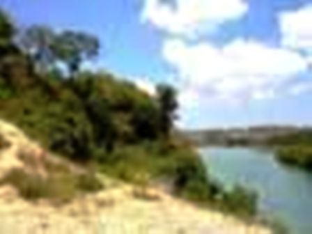
Antique has a mountainous terrain with 83 percent of its land classified as upland having slope of more than eight percent. The narrow coastal and the interior plains accounts for the remaining seventeen percent of the total land area.

The municipalities with large lowland areas which include Sibalom, San Jose de Buenavista, Hamtic, Culasi, Patnongon and Bugasong. Together with the municipalities of Barbaza and Tibiao account for most of the palay production of Antique.

The municipalities of Valderrama, Bugasong, Laua-an, Tibiao and Culasi account for about 24 percent of the very steep land of the province having slopes greater than 50 percent.

The mountain range stretching from Valderrama in the south to Culasi in the north has peak above 1,900 meters. Other mountain ranges have elevation from 500 to 1,300 meters.

The province is dissected by many river systems, the largest of which is the Sibalom which feeds the largest irrigation system in the province. There are seven major watersheds which are eroded in varying degrees of severity, including that of Sibalom.

Land Classification
About 53 percent of the land area of Antique is classified as alienable and disposable. Although a significant part, 47 percent is still classified as forest land and 53 percent is classified as alienable & disposable.

Land Use
As per survey conducted by Bureau of Soils and Water Management, agricultural land comprises 45,200 hectares or 17.90 percent of the total provincial land. The survey also indicates that the largest category accounting for some 121,400 hectares is not under cultivation and is covered by grasses, mainly cogon and shrubs. It is also reported in the survey that forest land accounts to 118,635 hectares.

Forest Cover
The province has 23,896 hectares of primary and secondary forest, equivalent to 9.5 percent of the provincial area. This natural forest is distributed along the less accessible, mountainous interior of eastern Antique.

Political Subdivision
The province is composed of 18 municipalities, 3 of which are inland, 14 coastal and 1 island municipality. Antique was classified as a 2nd class province as of January, 2002.

Economic Profile
Agriculture
For the year 2000, total production of palay, the primary crop of the province reeached 181,205 metric tons (mt.) or 4,530,125 cavans harvested from 59,662 hectares with an average yield of 3.04 metric tons per hectare. There is a slight increase in production of 2.07% over 1998 yeild. Since their is no significant increase in area harvested.

As to farm type, the average yield per hectare for irrigated lands is 3.38 mt., 2.62 mt. for rainfed farms and 1.76 for upland areas.
As it has been for years, our province had enough stock of this commodity to feed its population. For year 2000, we have a surplus stock of 29,955 mt. or 748,879 cavans of palay.

Copra, also major agricultural product, registered a total production of 12477 mt. during the year posting a decerease of about 20% against 1998 outpuit. The main bulk of copra came from the municipality of Caluya where the area accounts for about 44 percent of the total copra produced in the province. The area planted with coconuts constitute about 34 percent of the total area of the province.

Caluya, together with Pandan, account for more than half (51%) of the total provincial figure in terms of area planted, number of bearing trees, nuts production and copra yield. FisheryBy the end of the year, preliminary data for the Bureau of Agricultural Statistics (BAS) reported tthe fishery and marine products totalling 35,706 metric tons. The aquaculture sector yield the highest production during the inclusion of seaweeds in this sector.

Livestock and Poultry
Livestock and poultry raising in the province is through backyard or commercial system of production. Data from Bureau of Agricultural Statistics (BAS) revealed that from 1,595,577 heads of livestock and poultry in 1998, the number drooped to 1,428,266 in 2000, a decrease of 20%.

Forestry
Forest products include bamboo, rattan, buri, bariw, nito, log, charcoal, abaca, herbal vines and plants, wild flowers and others. These forest resources are of undetermined quantity, and are used as raw materials in construction industry, furniture and handicraft, herbal medicine, ornaments and other accessories.

Trade, Commerce and Industry
Major products shipped out of the province are palay, rice, copra, muscovado sugar, legumes, fruits & vegetables, livestock, fish & fish preparations and seaweeds. Manufacture items like native gifts, toys and housewares found their way in major cities of the country and abroad.

Principal mined products exported include coal, marble, silica, copper and gemstones.Main goods entering the province are construction materials, dry gooods, groceries, canned and bottled products, fertilizers and others.

The capital town of San Jose de Buenavista is the center of business hub mushroomed in the area. Potential growth areas include the towns of
Culasi, Pandan and Sibalom.

Banks and Other Financial Institutions
As of 2000, Antique has a total of 10 rural banks, five (5) private commercial banks and three (3) government banks; the Development Bank of the Philippines while Land Bank of the Philippines have branches at San Jose de Buenavista and Pandan, Antique.

There are also 101 multi-purpose cooperatives operating in the province of which 25 are strong and 96 are considered weak as assessed by the CDA Provincial Office.

Establishments
An establishment is an economic unit which engages under a single ownership or control. Department of Trade and Industry (DTI) classifies establishments as manufacturing, trade and service.

For the year 1998, 14 manufacturing establishments were reported. Such manufacturing establishments are making hollowblocks, wood furnitures, steel/wood, packed foods, metal craft, thresher, soap and sidecar. Service establishments totalled to 117 and a total of 294 trade establishments.

Mineral Resources
The mineral resources, metallic and non-metallic that abound the province are coal, marble, copper, gold, limestone, silica gemstone and others. An indication of oil deposit was recently discovered at Maniguin Island in Culasi.

Investment Opportunities
Investment opportunities with bright prospects in the province are the following:
Muscovado sugar industry
Seaweed processing
Marble processing
Gemstone and semi-precious stone processing
Coco oil mill
Livestock and poultry processing
Food Processing
Marine products processing
Furniture, handicraft, metalcraft
Fiber extraction/processing/weaving
High value crop production
Feed/Feed Milling

Coconut-based products.
Antique is one of the country's major coconut producers. Records of the Philippines Coconut Authority shows that Antique produced 79 millions nuts in 1995 with the big bulk of supply provided by the municipalities of Caluya, Pandan in the north and Sibalom in the south. The province's coconuts are converted into copra and further processed into coconut oil.

Muscovado.
Antique has been known to produce 60%-80% of the country's requirement of muscovado in 1970. Muscovado is moist, brown sugar, contains minerals beneficial to the body such as calcium and magnesium. In Antique, muscovado is produced through a chemical-free process which is favored by health-conscious consumers. Aside from this, cane agriculture is 100% pesticide-free with animal use of fertilizers. Eighty-five percent of Region 6's supply comes from Antique. Government will infuse funds to upgrade the mills and facilities to improve productivity and quality.

Bricks and pottery production.
Raw materials for brick and pottery production are abundant in Antique specifically in Tibiao, Sibalom, Laua-an. These raw materials are mostly surface deposits which make them easy to quarry. Appropriate and highly skilled technical production facilities can lead to mass production to meet the growing demand for clay-based product.

Gifts, toys and houseware.
Many Antique craftsmen are skilled in the art of making high-value lightweight handicrafts using local materials. This industry is not very capital-intensive and has a short payback period. These products already have an established market in Japan, the US and Europe.

Fish processing.
Inland fishing and aquaculture account for 36,193,365 metric tons offish production. There are 416,230 hectares of brackish water fishpond available. Total fishpond production is 26 metric tons of prawns, shrimps and rnilkfish. Eighteen deep-sea fishing operators haul an annual catch of 4,642 metric tons.

Gemstone processing.
The production of fashion accessories made of semiprecious stones has gained momentum in Antique. More capital and better technology are required to sustain the upward trend.

Seaweed culture and processing. To date, 3,500 persons are engaged in seaweed farming in an area of 3,000 hectares. Total land suitable for seaweed culture is about 5,000 hectares. Total seaweed production per month is approximately 600 to 800 tons, enough to supply a medium-scale processing plant.

Cutflowers.
Antique, like most of the region's provinces, has suitable land and climate for cutflower production. Demand for cutflowers from both the local and export markets is growing exponentially.

Pina weaving. Antiquenos weave and embroider very fine pina cloth. Few other provinces can produce this fabric which has a very upscale market because it is beautiful, as well as expensive to produce. The province needs better technology in processing and sustaining pina plantations. Presently, four cooperatives in Antique support the sector's development.
Tourism and resort potentials.
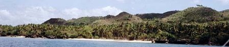
The province has considerable tourism potential. The long unspoiled and sparsely populated coastline of Antique provides opportunities to develop a number of facilities for tourism. The province has white-sand beaches, hot spring pools and majestic waterfalls. Adventurers can also explore various caves or go climbing up Madja-as mountain which locals have shrouded in legend.

A. Product
· MuscovadoMuscovado industry is composed of firms involved in sugar cane farming and muscovado milling. The miller make their mills available to other sugar cane farmers who have no mills for the processing of canes into muscovado sugar.

The major product produced by these farmers is muscovado sugar. The grade of muscovdao is dependent on the quality of sugar cane and the skill of "maestro", the person in charge of cooking.

B. Key players
· There are 144 single proprietors engaged in muscovado processing. These firms own muscovado mills, which serve as common service facility of sugar cane farmers within their area.

C. Market
· Domestic

D. Opportunities
· New technology on cane cultivation

History
The province passed through several historic periods namely: Pre-Spanish Period, Spanish Occupation, Philippine Revolutionay Government, American Occupation, Commonwealth (transition period), Japanese Occupation, and Philippine Independence.

History reveals that in the early time, ten datus from Borneo with their families, followers and slaves landed in Panay at a place called Sinogbuhan near the present site of the town of Miag-ao, Iloilo.

The Borneans found the place inhabited by Negritos living under the rule of Marikudo from whom the Borneans under Datu Sumakwel purchased the island for one gold sadok and one gold necklace. The island was later divided into three "sakops" namely: Hamtik, Aklan and Irong-Irong. In later times, Hamtik became Antique, Aklan became Capiz and Irong-Irong became Iloilo. Hamtik was placed under the superior datu named Sumakwel, who found a place known as Malandog, the first Malay settlement in the Philippines.

The Pre-Spanish natives of Antique had tribal government ruled by chieftains. They traded with neighboring countries like China and Malaya. They had their civilization blended with Negrito, Indonesian and Malay cultures enriched by cultural influence from India, China and Japan.

It is believed that the Spaniards found their way to Antique immediately after they established themselves in Oton, Iloilo. The Antiquenos resisted the invasion but in the end accepted Spanish rule, Christianity, the Spanish Colonial System and at the same time absorbed the social, cultural and educational system of the Spaniards. Antique then was created into a politico-military province in 1780 with the town of Hamtik as its first capital. In 1796, Antique, then known as Provincia de Bugason was given an independent status as a province. Later, the provincial government was established in Bugasong but was transferred to San Jose de Buenavista where it has remained since then.

Later on, the Antiquenos became tired of Spanish rule. They joined other Filipinos in their determination to have national independence which was established in Malolos, Bulacan on January 23, 1899 when Spanish rule in the Philippines was overthrown by the Americans. But this revolutionary government ended on April 19, 1901, with the capture of Gen. Emilio Aguinaldo and his taking oath of allegiance to the United States of America.

The Antiquenos enjoyed the noble policy of American occupation because self-government was given to them. During this period of our history, our political leaders joined in the achievement of Philippine Independence as promised by the Jones Law. The Tydings-McDuffie Law was passed by the United States Congress which provided for a ten-year transition period under the Commonwealth of the Philippines.

Hence, a constitutional convention was called to draft the constitution of the Philippines. Antiquenos elected the late Ramon Maza and the late Angel Salazar Sr. as their Con-con delegate in 1934. The Commonwealth lived until the Japanese Occupation.

Antique experienced many untold hardships during the Japanese Occupation. Many Antiqenos evacuated to the mountains and joined the guerilla movement. The Japanese stayed nearly four years.
Out of the ashes of the Pacific War emerged the Republic of the Philippines.

Manuel Roxas was the last President of the Commonwealth and the first President of the Republic. Atty. Emigdio Nietes was Antique's first Congressman under the Republic. Antique was able to produce the most powerful congressman in the Philippines in the name of Tobias A. Fornier who held the position of the Chairman of House Committee on Appropriations.

From this time on, a lot of things occured and changed in the province.

Labels: ,

Capiz

Overview
Dubbed as the “Seafood Capital of the Philippines”, Capiz boasts of its 80-kilometer coastline and wide expanse of swampy lands easily converted into fishponds.

It holds one of the richest fishing grounds and a major contributor in the aquamarine industry.

A place full of enchantment and mystery, several legends and beliefs claim stories to which the name “Capiz” originated. More popular of these is that it comes from the word “Kapid” (which means twin).

When Spaniards settled in the place they found difficulty in pronouncing the name Kapid, thus giving birth to the word “Capiz”. Still, some old folks claimed that Capiz got its name from “Kapis” a shell of the mollusk family that is very much abundant in the place.

Capiz is one of the provinces comprising the Western Visayas Region. The province is blessed with a very rich fishing grounds that made it popular as the Seafood Capital of the Philippines. Farming and fishing are the primary sources of income of the people. Apart from a surplus of agricultural products it generates every year, Capiz is also the country’s major suppliers of prawn and bangus.

Geography
The Province of Capiz occupies a land area of 2,633 square kilometers, representing 21% of the total land area of Panay. It is composed of 16 municipalities and a city with a total of 472 barangays.

Political Subdivisions
The province is composed of 16 municipalities comprising 473 barangays. It is divided into two political districts: 1st District covers the municipalities of Maayon, Panay, Panitan, Pilar, Pontevedra, Pres. Roxas, and Roxas City; while the 2nd District covers the municipalities of Cuartero, Dao, Dumalag, Dumarao, Ivisan, Jamindan, Sapi-an, Mambusao, Sigma, and Tapaz.

Population
As of the year 2000 survey, Capiz has a population of 654,156.

Language
Hiligaynon is the dominant dialect spoken in the province.

Climate
The province has a 3rd type of climate, seasonal changes are not pronounced. Relatively dry from November to April and wet from May to October.

Trade and Industry
The even distribution of rainfall throughout the year and the infrequent occurrence of typhoons make the province highly suitable for agriculture, aquaculture, and other related activities – which explains why these are major industries of the province.

Farms for orchids, various ornamental plants, and different varieties of heliconia supply a thriving cut-flower business that is carving a market niche in Southern Philippine provinces.

The land has also proven to be good grazing ground for cattle and for raising swine, goats, and poultry. Its long coastal areas abound with “kapis” shells, which are used in the manufacture of exportable novelty items.

Numerous home and cottage industries amply augment household incomes, among which are poultry, livestock raising, handicraft, shell-craft, ceramics, lime processing, garments, farm-tool fabrication, furniture and boat making.

The even distribution of rainfall throughout the year makes the province highly suitable for agriculture and aquaculture industries. Capiz is also the biggest rice and corn producer in the region.

Its waters teem with the best gifts of the sea -- blue marlin, tuna, prawns and shrimps, crabs, eel, shellfish and other marine species. Prawn and milkfish are also cultured in fishponds.

Agriculture and fishing dominate the economy of Capiz. Palay, corn sugar cane and coconut are the main crops of the province. The coastal waters of Capiz constitute one of the richest fishing grounds in the Western Visayas. Fishponds abound with a total area of 20,000 hectares.
The combined catch of aquamarine products make Capiz one of the major producers and suppliers of milkfish, crabs, shrimps and prawns. The industry sector includes manufacturing of garments, furniture-making, bakery and processed foods, handicrafts and shellcrafts, and processing activities such as food, oysters, mussels, fish and prawn processing.

As the Garden Capital of Northern Panay, Capiz farms grow orchids, various ornamental plants and flowers that supply a thriving cut-flower business. Different varieties of heliconia supply a thriving cut-flower business that is carving a market niche in Southern Philippine provinces.

The province has total exports of 1,671,637. There are mostly frozen prawns, crab meat and clams canned oysters and mussels, gifts and housewares, horticultural products and electronics. Export markets of these products are Europe, USA, Japan, Singapore, Canada and South Africa.

History
Legends have it that the name of Capiz came from Akean and Kapid (meaning -"twin") which Balingagan, Datu Bangkaya's eldest son, named his "sakups" (territories) in honor of his twin daughters "Bulan and Adlaw" (Moon and Sun).

Another version was based on the story that when the Spaniards came to settle it was the time when the wife of Bangkaya (head of the Aklan District then) gave birth to twin daughters. Twin in the local dialect is "kapid" but the settling Spaniards adopted the name of "Capiz" either due to their difficulty in pronouncing the "d" in "kapid" or as inadvertently miscommunicated to them by the natives.

Still, some old folks believed that Capiz got it's name from "Kapiz" or "pios" (a shell in the mollusk family) which were found in abundance at the time. Centuries before the coming of the Spaniards to the country, Capiz was one of the early settlements of the Malays. It formed part of the Confederation of Madya-as after the purchase of Panay Island by the Bornean Datus from the Negrito King Marikudo.

Panay was divided into three major districts and the Aklan District that included Capiz was formally formed in 1223. Later, Datu Kalantiao, heading the Madya-as Confederation and as chief of Panay Island, promulgated the famous code of Kalantiao sometime in 1433. In the Spanish era, Capiz became the second Spanish settlement in the Philippines when the Spaniards, under the Miguel Lopez de Legaspi entered Pan-ay, a town of Capiz, in 1569. May 8, 1570 marked the conquest of Panay and consequently the district of Aklan under the leadership of Martin de Gotti.

Capiz was created into a separate "encomienda" and later was organized into a politico-military province in 1716, emracing the neighboring islands of Romblon, Nuestra de Campo, Tablas and Sibuyan.

Capiz, was not the capital of the province but the town of Pan-ay. However, when the Spanish discovered that Capiz is near the sea and had better docking facilities for their galleons, they moved the capital to its present site. The Americans established a civil government on April 15, 1901. Simplicio Jugo Vidal was appointed by William Howard Taft as first Municipal President.

On May 12, 1951, the town of Capiz was converted into the City of Roxas, named after one of its' most illustrious and famous son -- the late First President of the Philippine Republic Manuel Acuña Roxas. In 1954, by virtue of the R.A. 1414, Aklan was separated from Capiz and made into a distinct province.

Investment Opportunities
Product

Holticulture
The Capiz holticulture industry is composed 156 producers. total land area planted as of 2000 is 60 hectares.

The products and services of the industry includes cutflowers, pot plants, cutting, cutfoliage, landscaping materials non-soil rooting media, processed ornamentals, floral arrangement services, landscaping services.

Some of the flowers used as orchids, anthuriums, chrysanthemums, various ornamental plants, and different varieties of heliconia.

Key players
14 major players, 7 of them are direct exporters
Market
Domestic
Opportunities
Direct supplier of nets, fertilizers and chemicals
Technology provider on the following areas:
R & D on orchid tissue culture
Appropriate potting medium requirement
Manufacturers/suppliers of vases, plant holder, flower baskets, decorative jars

Labels: ,